
India and NASA Just Launched NISAR, an Earth-Observing Satellite, From India!
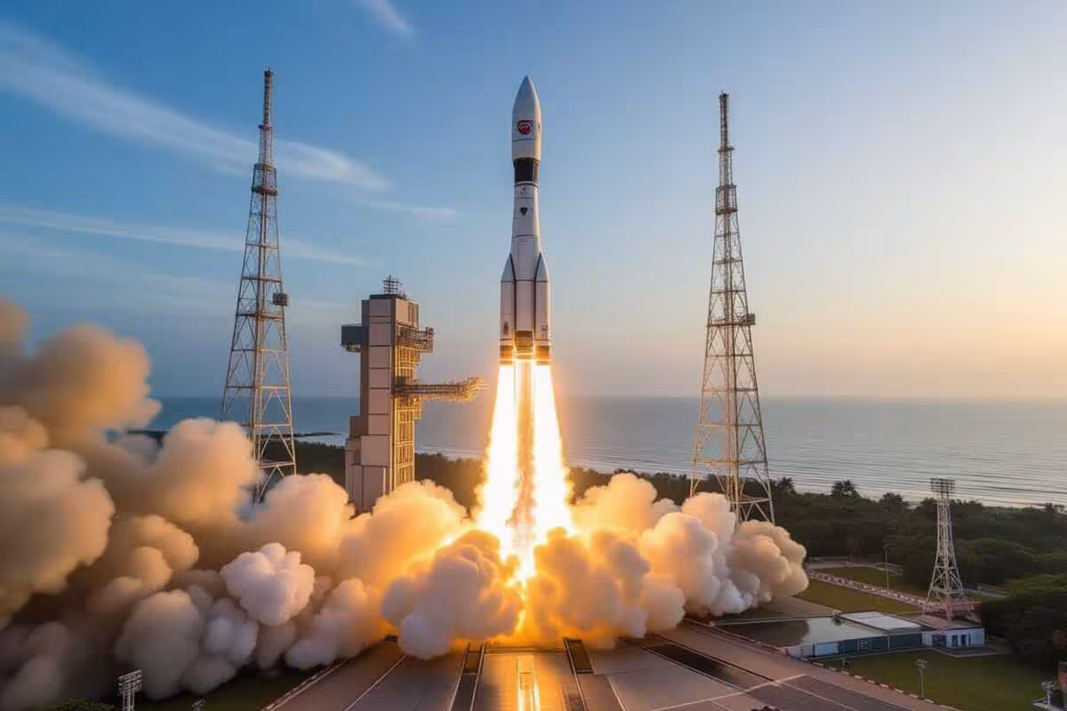
SRIHARIKOTA, Andhra Pradesh, India – July 31, 2025: Big news in space! India and the U.S. just launched the NASA-ISRO Synthetic Aperture Radar (NISAR) satellite from the Satish Dhawan Space Centre. This advanced Earth-watching satellite is a team effort by the Indian Space Research Organisation (ISRO) and NASA. It blasted off on a Geosynchronous Satellite Launch Vehicle Mark II (GSLV Mk II) at 5:30 AM IST. This launch is a big deal for countries working together to understand our planet.
What NISAR Will Do: Getting Earth Info Like Never Before
NISAR’s big goal is to take measurements all over the world to figure out why and how the Earth’s surface is changing. With its special L-band and S-band Synthetic Aperture Radars (SAR), NISAR will see Earth in a way we’ve never seen before. It’ll grab info from all land and ice every 12 days. These radars will spot tiny changes on Earth with super-sharp detail.
The data from NISAR will be super useful. It’ll help us learn about melting ice, keep tabs on earthquakes and landslides, figure out what’s messing with nature, and watch farms and forests. The cool thing is, it can see through clouds and darkness, so it’s always on the job.
ISRO and NASA: A True Partnership
NISAR shows how well ISRO and NASA work together, each bringing their skills to the table. NASA built the L-band SAR, a fast data system for the L-band radar, a GPS thingy, a recorder, and the data system. ISRO is in charge of the S-band SAR, the GSLV Mk II rocket, and the spacecraft itself. This mission shows how cool it is when countries team up in space.
For years, teams from both groups worked side-by-side to plan, build, and test the satellite. Today’s successful launch proves how dedicated and talented the scientists and engineers are.
The Rocket and Getting Into Orbit
ISRO’s GSLV Mk II did its job perfectly, putting NISAR into the right orbit about 747 kilometers up. This orbit means the satellite sees the same spot on Earth at the same time each day, so the data it collects will be consistent for its three-year mission.
After the satellite separated from the rocket, ISRO’s tracking network (ISTRAC) took over. Everything looks good so far, and the big radar antenna should be up and running soon.
Sharing the Data and Why It Matters
NISAR’s data will be available to scientists everywhere, encouraging teamwork on important Earth science issues. People all over the world can use this data to learn more about how our planet works and make better choices about climate change, disasters, and resources.
This mission should really help us keep an eye on Earth and make models, giving us key info on the effects of climate change. It’ll also help communities worldwide get ready for and deal with natural disasters.
What’s Next for India and the U.S. in Space?
The NISAR launch makes the partnership between India and the U.S. even stronger. Both countries are looking at more ways to work together on things like studying planets, space travel, and new space tech. This mission is a great example of how working together can push science forward and solve problems for everyone.